| The default sky map is displayed using Google Maps with a Mercator projection, just like the Earth map. It's oriented with the celestial equator horizontal and the North star at the top. This will seldom match the orientation of the sky at your location; the Change view button rotates the map so that your local horizon will be horizontal and moving up on the map matches looking upward in your sky. |
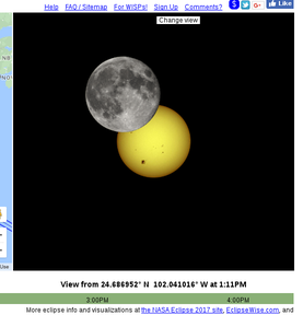
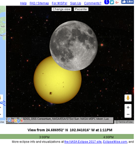
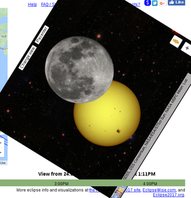
| This view keeps the Sun centered in the window and places the Moon as it will appear at the given time and location, eg. up is towards the top of the sky, not the North star. |
| Here we rotate the Google Map so up is towards the top of the sky, not the North star. |
We'll keep working on this and we welcome suggestions as to how to make it more intuitive.
Planet positions and timings
Position data for the Sun, Moon, planets and asteroids is obtained from the telnet service of NASA's Jet Propulsion Laboratory HORIZONS System. We use geocentric positions for the Sun and Venus, but topocentric positions -- based on the viewer location set in the Earth pane -- for the Moon and Earth's shadow and closely approaching asteroids.Our computations generally come close to NASA's, but they are not identical. For precise eclipse timings and locations, visit the NASA Eclipse web site.
Sun and Moon image details
The images of the Sun and Moon are fixed and do not reflect their current conditions or orientation. The Sun's surface is actually very dynamic; you can see current images at spaceweather.com. The precise area of the Moon visible during a full Moon varies as well.
For the Earth's shadow, we compute the radius of the Earth's shadow's umbra and penumbra at the distance to the Moon, and draw the penumbra with a 50% gray, 50% transparent PNG and the umbra with a black, 50% transparent PNG. In the computation we use the radius of the Earth at latitude 45° and apply Danjon's empirical rule of increasing the radius by 1/85 to account for the Earth's atmosphere.
The images of the Sun, Moon and planets were found by browsing the NASA Planetary Photojournal, Wikipedia, and the Wikimedia Commons. We converted to PNG, cropped the planets and made the backgrounds transparent, and reduced sizes. The Moon image used for solar eclipses and the Venus image used for the transit are darkened from the original. The image used for the February 2013 close approach of asteroid 2012 DA14 is actually of another asteroid, Ida, and is shown about 10,000 times larger than 2012 DA14.
Here are the sites where the images can be found and credits as they appear on those pages. Uncredited images are from the NASA Jet Propulsion Lab, the NASA Marshall Space Flight Center, and the Wikimedia Commons.
Sun
Moon (Credit: Luc Viatour www.lucnix.be)
Mercury (Credit: Mariner 10, Astrogeology Team, U.S. Geological Survey)
Venus
Mars (Credit: NASA, J. Bell (Cornell U.) and M. Wolff (SSI))
Jupiter (Credit: NASA/JPL/University of Arizona)
Saturn (Credit: NASA/JPL/Space Science Institute)
Uranus
Neptune
Pluto (Credit: Dr. R. Albrecht, ESA/ESO Space Telescope European Coordinating Facility; NASA)
Ida